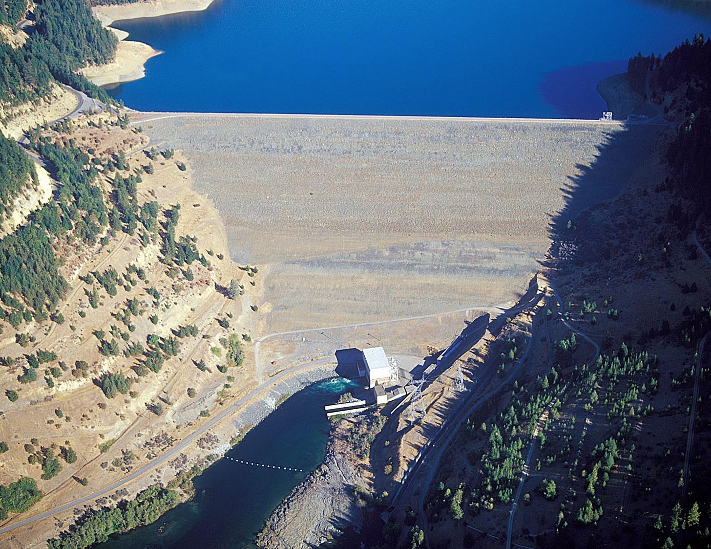
A Wall of Water 250 Feet High
Climate Change Bodes a Disastrous Dam Failure for the North State
By Tom Stokely, C-WIN Board Member
The current catastrophic drought is re-enforcing the general sense that California is becoming hotter and drier due to climate change. And to a real degree, that’s true. But the full story is somewhat more nuanced – if not necessarily more reassuring – than that.
It’s true California is likely to face more frequent droughts in coming decades. But virtually all reputable climate change studies – including a 2020 UCLA analysis – confirm that the state will also be dramatically wetter in some years. That’s because the greatest effect of climate change on the state is increased weather variability.
Precipitation will likely be “average” to “dry” in most years, but this record will be punctuated by extremely wet years characterized by “atmospheric rivers” – massive low-pressure systems that deliver storm after storm from the southern latitudes. An extended series of atmospheric river events are known as “ARkStorms;” the “k” in the term implies they are rare, typically happening once in a millennium. But a recent report by UCLA climatologists Xingying Huang and Daniel Swain found that the chance of an ARkStorm-induced megaflood has increased dramatically due to climate change.
Despite their historic rarity, megafloods have always been part of life in California. The biggest one on record hit in 1862 and flooded the entire Central Valley, killing 4,000 people. But they will become more common as climate change accelerates. And the state’s flood control infrastructure is unprepared for such a shift. California is now in a water deficit crisis – but that inevitably will shift during some future winter as too much water from a relentless series of storms inundates the state, overtopping dams with disastrous results.
Data from a peer-reviewed 2019 study analyzed likely climate change-induced flood hazard risks at 13 major California dams. The warming planet, the report noted, has increased the chance of major flooding by 500% for some of the state’s drainages. And while the report determined that dam failure risk is high for most of California’s large dams due to the changing climate, Trinity Dam and its associated downstream facility, Lewiston Dam, are particularly vulnerable.
Unfit for the 21st Century
Completed in 1962, Trinity Dam is an earth-fill dam on the Trinity River about seven miles northeast of Weaverville, California. Its construction has created Trinity Lake, the third largest reservoir in the state. As the centerpiece reservoir of the federal Central Valley Project (CVP), the Trinity facility provides hydropower and water for Central and Northern California farms and cities.
When it was constructed, Trinity Dam was considered more than adequate to contain any significant runoff. That may – or may not – have been true in 1962. But in an era of accelerating climate change, it is clear that Trinity Dam is likely to fail during a sustained ARkStorm event. Such a failure would result in a wall of water up to 250 feet high. It would take eight hours to reach the Pacific Ocean, devastating numerous riverside towns, and the Hoopa Valley and Yurok Indian Reservations.
In recent years, catastrophic dam failure risk has focused on Oroville Dam, the country’s highest earth-fill dam; it almost failed during a 2017 megastorm event from spillway erosion and near overtopping. But Trinity Dam is at even higher risk for calamitous failure due to its ill-designed outlet structures. Oroville can release more than 600,000 cubic-feet of water per second (cfs), while Trinity Dam can release only about 35,000 cfs. That means Trinity Dam is unable to accommodate what water managers call the “Probable Maximum Flood.”
Simply put, Oroville is designed to release large volumes of water well before the reservoir is full. Trinity isn’t.

No Place for High Water to Go
Oroville’s flood control outlet is 88 feet lower than its emergency spillway and 109 feet below the dam crest. And the emergency spillway is configured to release a great deal of water quickly. Trinity, on the other hand, has no emergency spillway, and none of the outlets other than a “glory hole” spillway 25 feet below the dam crest can expel significant amounts of water.
This means that Trinity Dam is unable to drain the reservoir quickly in an emergency event. The only reason the dam didn’t fail during sustained storm events in 1964, 1978 and 1997 was because the reservoir was low enough in those years to accommodate heavy storm inflows.
The design of Lewiston Dam and Reservoir – located just below Trinity Dam – only compound the danger. Lewiston has a release capacity of 30,000 cfs, making it utterly inadequate for dealing with an ARkStorm emergency. Also, the existence of downstream homes, bridges and infrastructure on the Trinity and Klamath Rivers may hamper or discourage dam managers from releasing enough water to avoid ultimate catastrophe; they may be inclined to “hope for the best” until it’s too late.
No Time to Waste
To avoid disaster, Trinity’s managing agency, the U.S. Bureau of Reclamation, must revisit the structural options and operational rules for the dam and install an adequate advance warning system to signal imminent overtopping. Speed is of the essence. The risk for catastrophic failure at Trinity Dam is high – and it will only increase over time.


Has the Oro emergency spillway upgrade created a viable overflow facility? What megastorm vulnerabilities does Shasta Dam have?